RESTORE+: Addressing Landscape Restoration on Degraded Land in Indonesia and Brazil
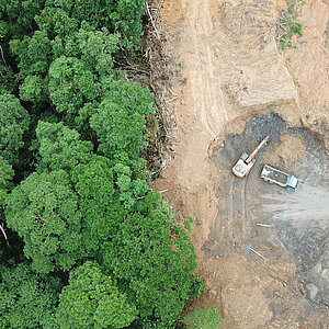
Although crucial for many activities, the availability and accessibility of map data in Brazil and Indonesia are often limited. This limitation hampers detailed planning of forest and landscape restoration, as well as mobilization of financial and institutional resources that require baseline setting and monitoring of results. In the context of avoiding deforestation, data limitation will also result in limited ability to participate in markets that incentivize/enforce sustainable practices. The project aims to deliver mapping technologies to help key actors access high-quality data in planning, mobilizing funds, and implementing efforts to avoid deforestation and restore degraded forests and landscapes. Additionally, the project will also derive insights for national policies and long-term strategies to further demonstrate the multiplier effect of high-quality map data towards increased capacity for delivering land use sustainability.
- Countries
- Brazil, Indonesia
- IKI funding
- 12,498,171.00 €
- Duration
- 03/2017 till 12/2028
- Status
- open
- Implementing organisation
- International Institute for Applied Systems Analysis (IIASA)
- Political Partner
-
- Brazilian Cooperation Agency (ABC)
- National Research and Innovation Agency (BRIN) - Indonesia
- Implementing Partner
-
- SELPER Brazil
- World Agroforestry Center (ICRAF)
- Online
State of implementation/results
- Epistem, the second phase of the RESTORE+ project in Indonesia, has established a community of practice called Karsa Bentala in South Sumatra to ensure the project meets real user needs. The community brings together four government institutions; the Plantation Office, the Forestry Office, the Social Forestry Agency, and the Regional Development Planning Agency; along with local actors working on nature-based climate solutions. Through awareness-raising activities, technical workshops and field data collection, partners are strengthening their capacity in satellite-based landscape monitoring while contributing user requirements directly to the development of Epistem tools.
- Luma (Land Use Mapping for All), the first open-source landscape monitoring platform developed under Epistem, is now publicly accessible through its dedicated web portal (luma.epistem.io). The current version is a teaser version with limited functionality that will continue to mature through ongoing co-development. Luma builds on the earlier RESTORE+ land cover classification approach and provides user-friendly workflow guiding practitioners through satellite image selection, data preparation, land use and land cover classification, and map validation. The open-source repository (github.com/…) provides access to the mapping algorithms, reference datasets, licensing information, and disclaimers to ensure transparent and responsible use.
- As part of this co-development process, partners are developing three practical case studies on restoration monitoring, palm oil expansion, and coffee agroforestry mapping. Development versions of Luma have been tested across its main modules, generating structured user insights that have been incorporated into further development. A comprehensive technical design document defines the platform’s architecture, workflows, and long-term roadmap. The source code has been restructured to support maintainability and community contributions through a version-controlled repository shared among consortium partners, including the National Research and Innovation Agency of Indonesia (BRIN). Collaboration will expand to partners in South Sulawesi and East Nusa Tenggara to ensure the landscape monitoring approach is relevant across Indonesia.
- In Brazil, the RESTORE+ project released the first public version of a geographical database for the Rural Environmental Cadastre (CAR) covering the Legal Amazon. CAR is the main system used by the Brazilian government to monitor land use on private properties and enforce the Forest Code. Making this dataset publicly available improves transparency and supports better monitoring of deforestation and forest restoration. The database is available at zenodo.org/… and will continue to be expanded and refined before the final version is delivered in 2027.
- The project also continues to strengthen Brazil’s forest monitoring capacity through the open-source software SITS (Satellite Image Time Series Analysis) developed with the National Institute for Space Research (INPE). An operational version capable of mapping deforestation in the Amazon has been released at github.com/…, with documentation at e-sensing.github.io/… A recent assessment showed 95 percent agreement between maps produced by SITS and Brazil’s official deforestation monitoring system PRODES, demonstrating the reliability of the automated approach.
- Using technologies developed by the project, new land use and land cover change maps for the Amazon and Cerrado biomes have been produced by INPE and the Brazilian Agricultural Research Corporation and are available at www.terraclass.gov.br/… The project team has also released a long-term land-use dataset for the Amazon biome (zenodo.org/… ; description at restore-plus.github.io/…), which supports the development of national greenhouse gas emission scenarios. In parallel, work is underway to adapt the MagPIE land-use model to Brazil in order to support future policy discussions on agricultural expansion, forest restoration, and long-term climate mitigation pathways.
Latest Update:
07/2026
Further links
Project relations
Legend:
The link has been copied to the clipboard